KENDRY PROPERTY
Project Description
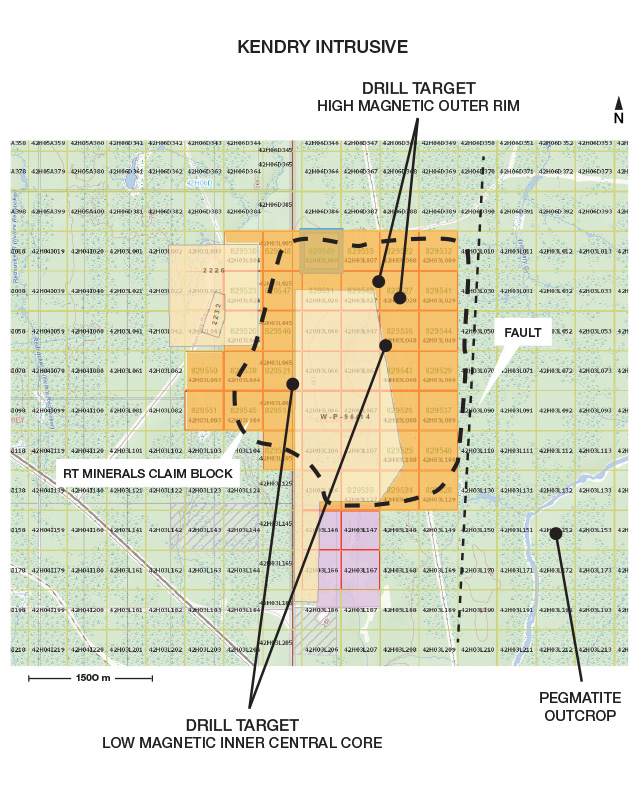
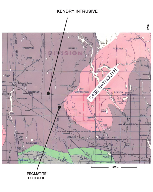
The Kendry property is comprised of 32 claims that the Company acquired a 100% royalty free interest by map staking (MLAS, Ontario) in the Kendrey and Colquhoun Townships located 14 km southeast of Smooth Rock Falls, Ontario.
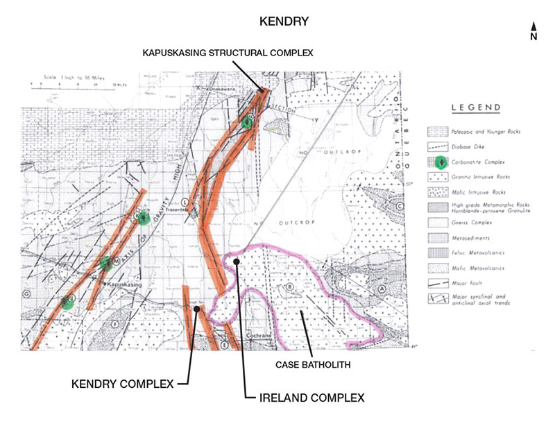
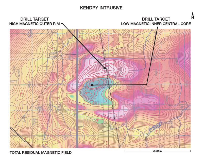
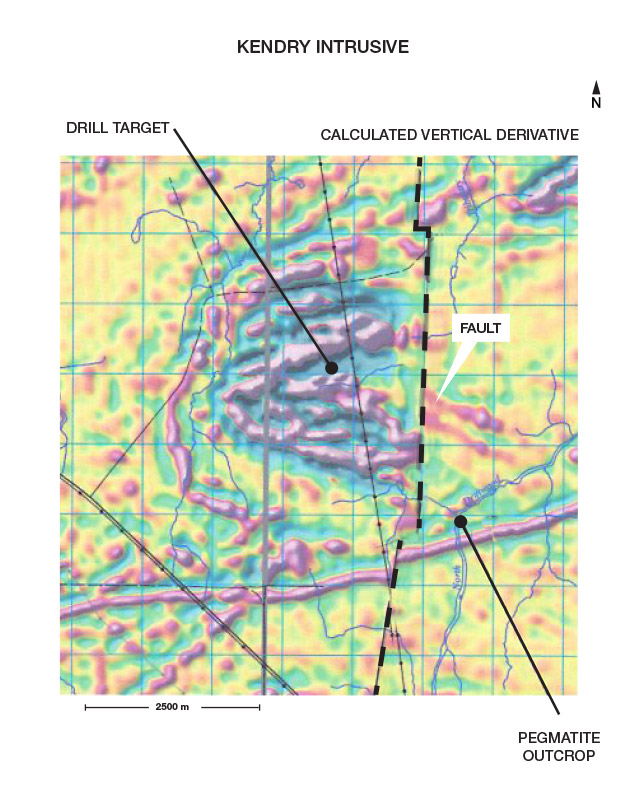
The Kendrey property covers what appears to be a large, inferred carbonatite complex that is prospective for rare earth elements, specifically niobium. The intrusive is approximately 2.8 km wide and 2.7 km long. It is positioned along a southeastern extensional splay fault belonging to the Kapuskasing Structural Trend. The magnetic signature is very similar to several documented carbonatite complexes that contain an internal low magnetic central core surrounded by a highly magnetic circular outer ring (MNDM files PO 452, M82813, M82824). The intrusive is bounded to the east by a large north-south trending fault.
QUALIFIED PERSON
The technical information contained in the above text has been reviewed and approved by Mr. Garry Clark, P.Geo., a “Qualified Person” as defined in National Instrument 43-101 – Standards of Disclosure for Mineral Projects.