IRELAND PROPERTY
Project
Ireland
Location
Ontario
Targeted Resources
- Niobium
- Iron
- Titanium
- Rare Earth Elements
Project Description
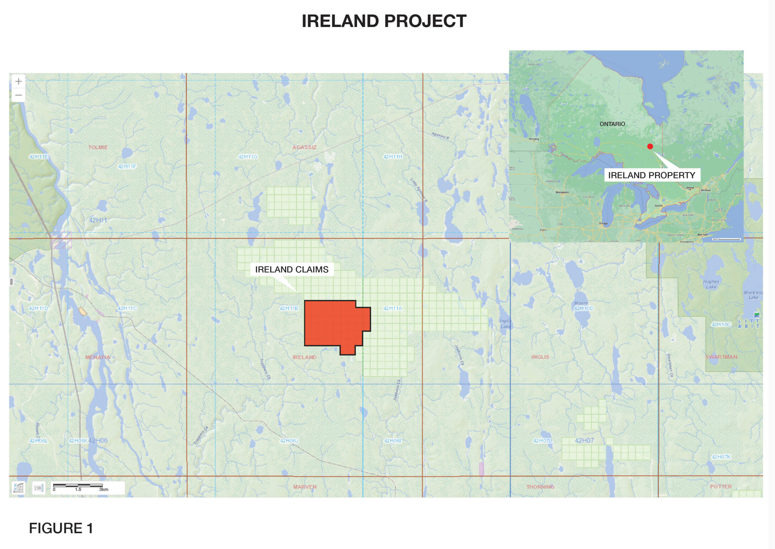
The Ireland REE property is comprised of 52 claims (421 hectares) covering an inferred carbonatite complex (the ``Ireland Complex``) located in Ireland Township, 45 km northeast of Smooth Rock Falls, Ontario. The Ireland Complex is positioned along a southern extensional splay fault contained within the Kapuskasing Structural Trend, which contains several well documented carbonatite complexes that contain niobium, iron, titanium and rare earth element resources within various assemblages of carbonatite rocks. The Ireland Complex is 100% owned and royalty-free.
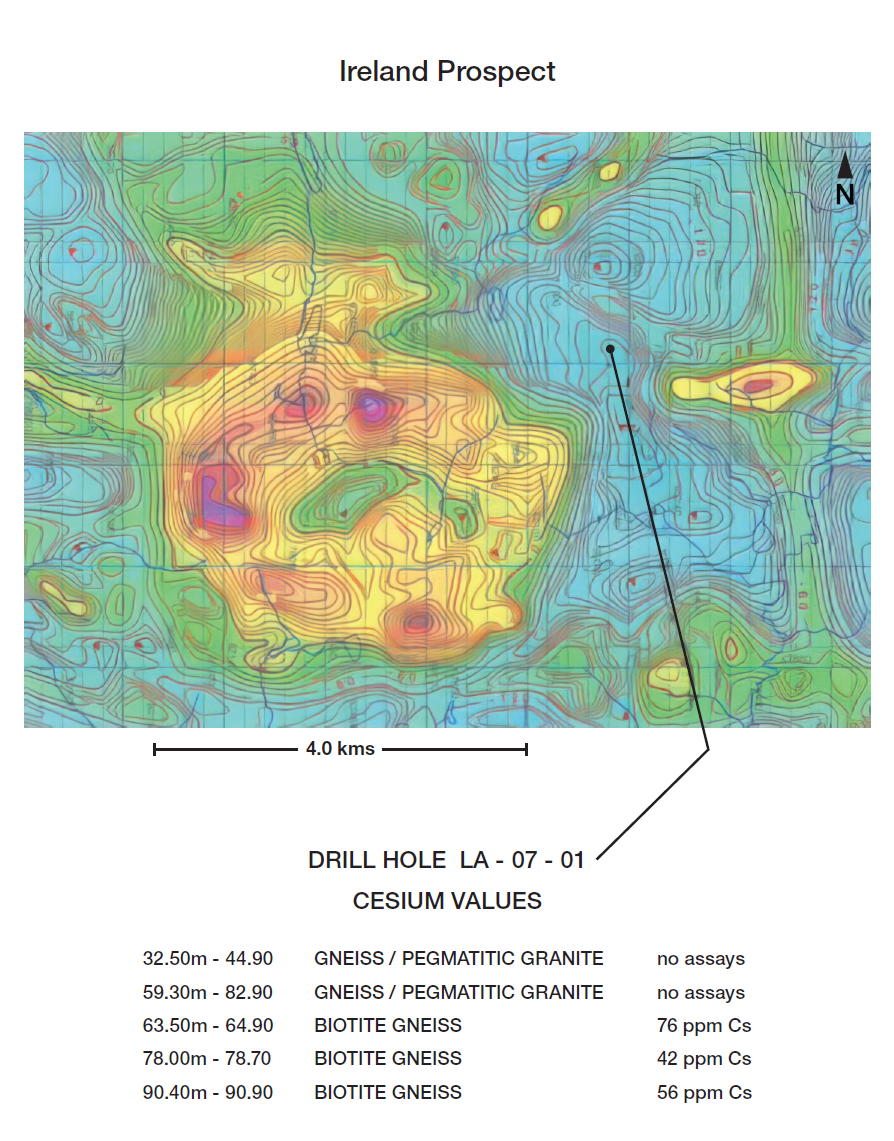
The Ireland property lies within the eastern extension of the Quetico Basin and may be part of the Opatica Subprovince. Both geological provinces contain metasedimentary and migmatic rock assemblages. The metasedimentary sequences are highly metamorphosed assemblages of greywacke, siltstones and iron formation intruded by igneous granitoids, mafic-felsic bodies and ultramafic complexes cut by numerous north-south trending Diabase dykes of the Abitibi - Hearst dyke swarm (ODM misc. Paper 10). The entire claim block is covered by thick glacial overburden. As a result, the basic geology is interpreted as being dominated by northeast trending quartz-feldspathic metasedimentary gneisses containing variable amounts of granitic intrusives. The property is underlain by a highly magnetic circular intrusive? complex along with a smaller intrusive? located to the southeast. Both intrusives are currently interpreted as potential Carbonatite assemblages. Three historical boreholes are located around but not within the intrusive complexes. Boreholes LA 07 - 01, 03 and 04 were drilled by Lake Shore Gold in 2007 (mndm files 20000003914/20005893). The boreholes were drilled to a depth of 251m and represent the only valid information on the immediate geology around but not within the Ireland complex.
The boreholes encountered three major rock assemblages: (i) fine grained clastic metasedimentary rocks and remnant iron formation (gneiss); (ii) granitoids -monzonite, granite and graphitic granite; and (iii) garnetiferous biotite gneiss. All three rock assemblages are intercalated with variable intervals of mafic and intermediate metavolcanics with minor intrusive units (diabase dykes).
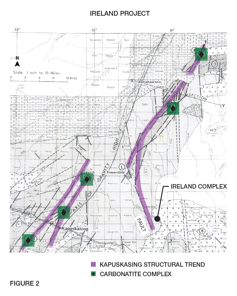
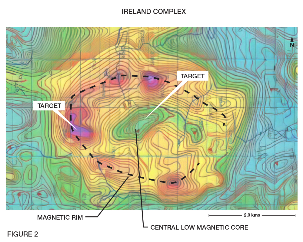
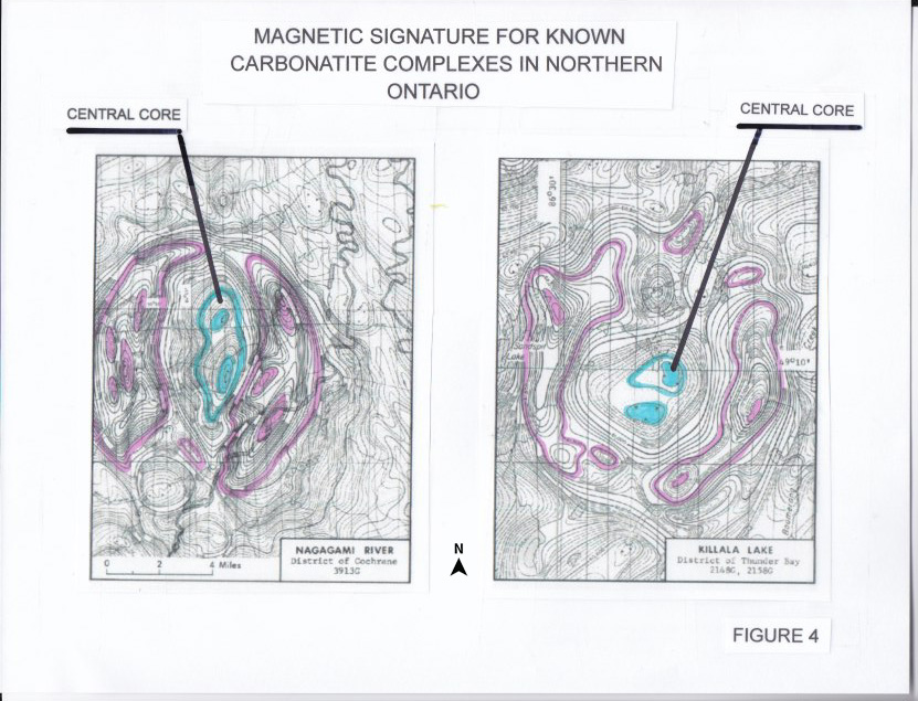
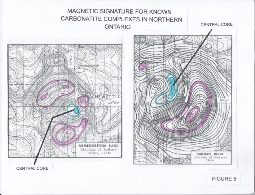
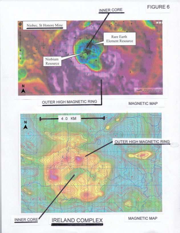
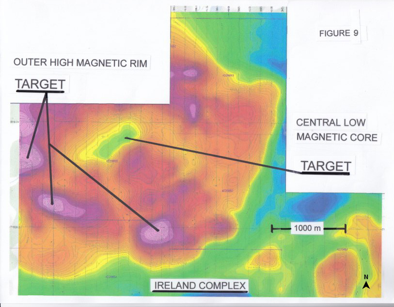
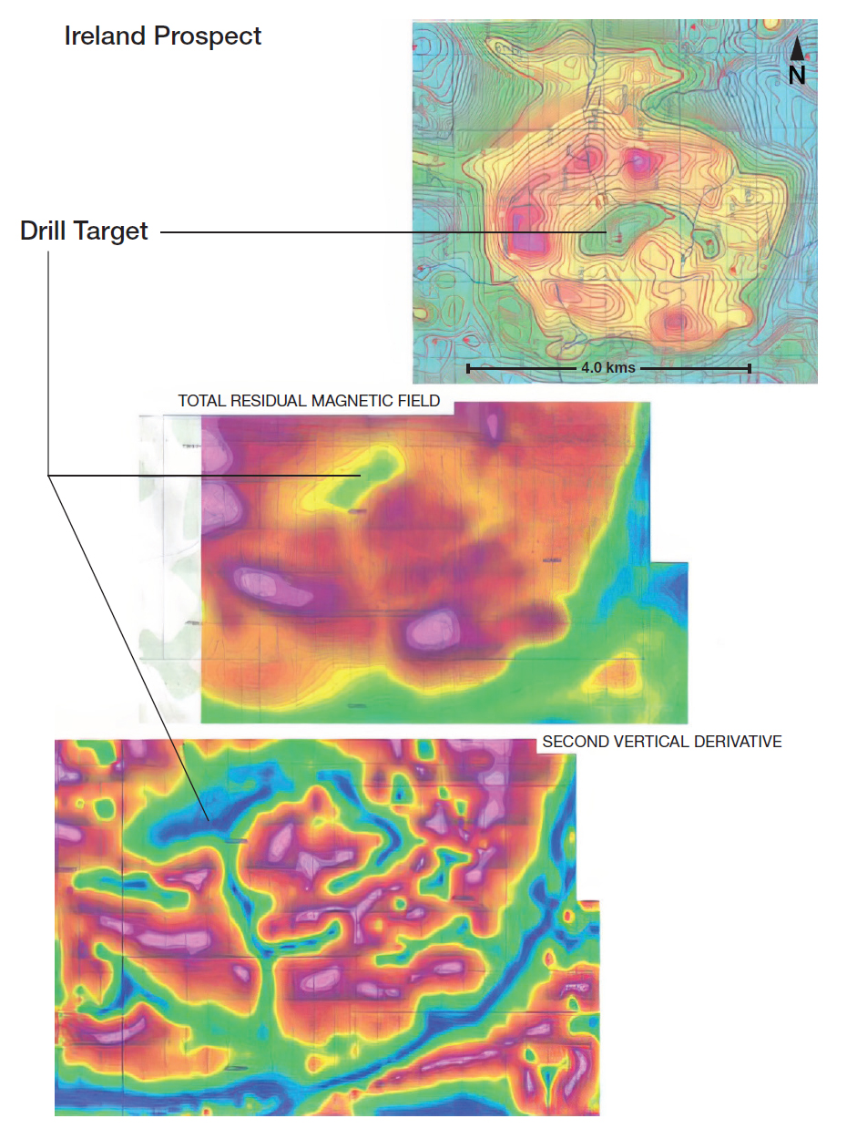
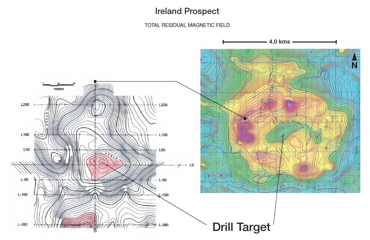
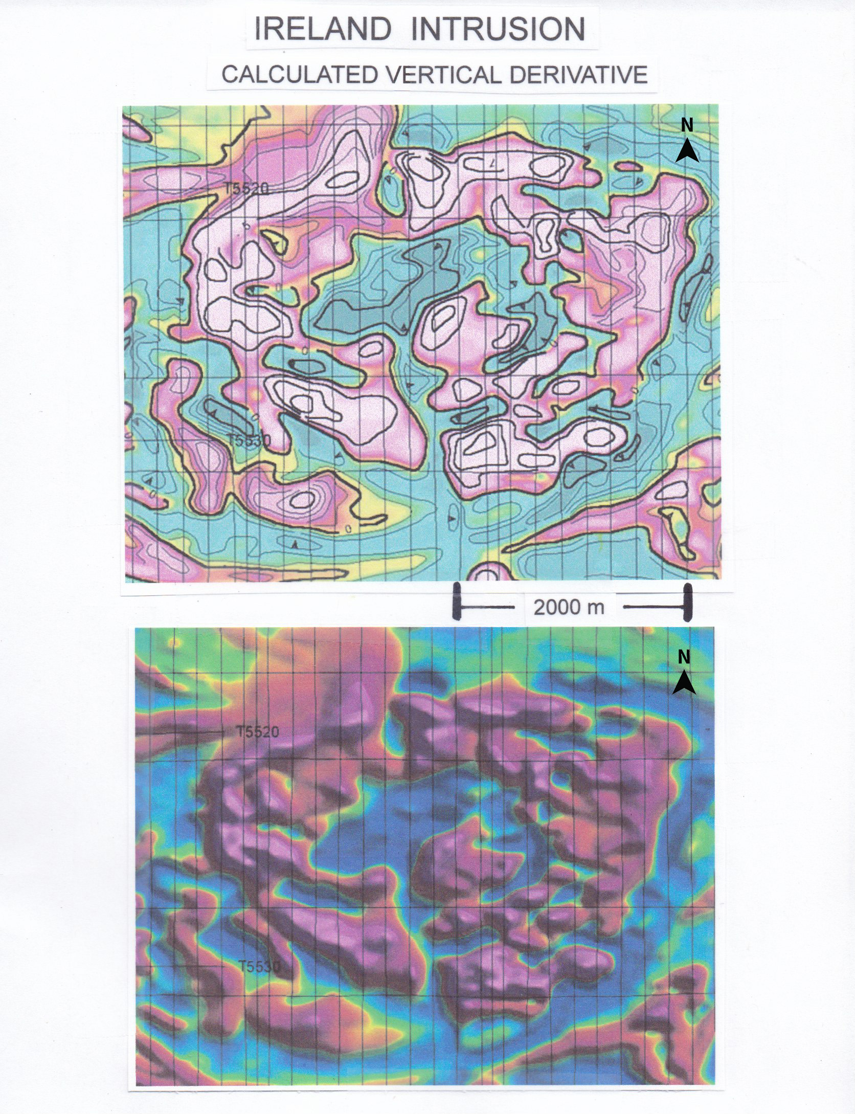
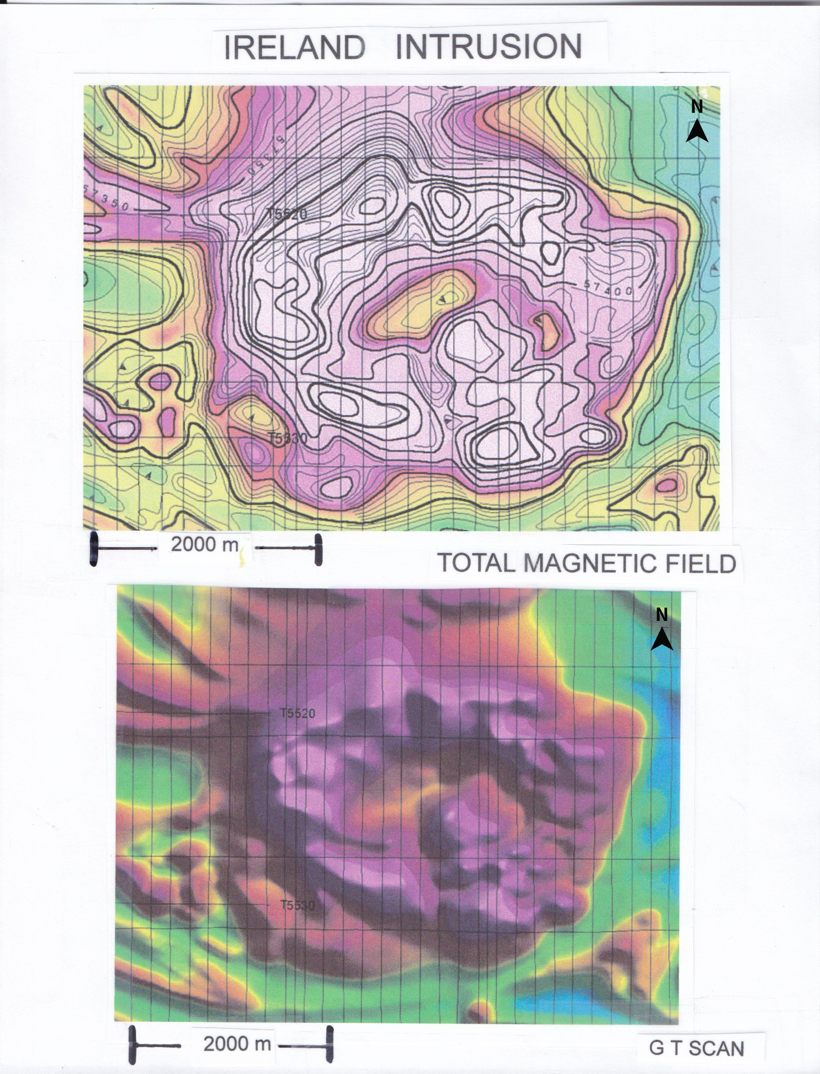
The Ireland complex is approximately 4.1 km long and 3.0 km wide. It is positioned along a southeastern extensional splay fault belonging to the Kapuskasing Structural Trend. The Kapuskasing Structural Trend contains several well documented Carbonatite complexes located along these fault structures (Figure 2, mndm files ODM Misc. paper 10 OGS open file report 5967). The magnetic signatures (total magnetic field) for those complexes are very similar for that of the Ireland complex (mndmfiles PO452/PO420 M82810 M28216, Figures 3, 4 and 5). In particular, the Carbonatite complexes contain an internal low magnetic core surrounded by a highly magnetic circular outer rim. The overall dimensions of the complex correlate very well with the known Carbonatite complexes in Ontario and Quebec. The Ireland complex and geophysical signature is also very similar to the producing Niobec Mine1 in Quebec (Figure 6).
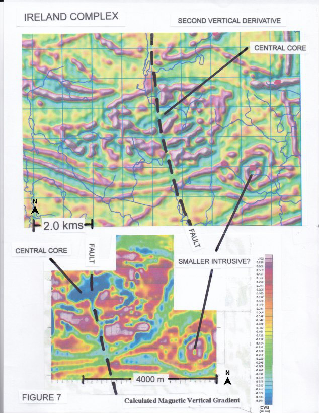
At Niobec, the inner core magnetic low signature contains niobium and the rare earth element (REE) mineralization. The magnetic data covering the Ireland complex suggests the development of an outer circular high magnetic pyroxenite? ring transitioning into an inner ring of calcite (sovite) Carbonatite to a central low magnetic signature inner core of dolomite (rauhaugite) Carbonatite that contains the rare earth elements (Figures 3 - 6). A detailed calculated/ second vertical derivative magnetic display is shown on Figure 7 over the Ireland complex (mndm files 42GO2NE2002 M82821).
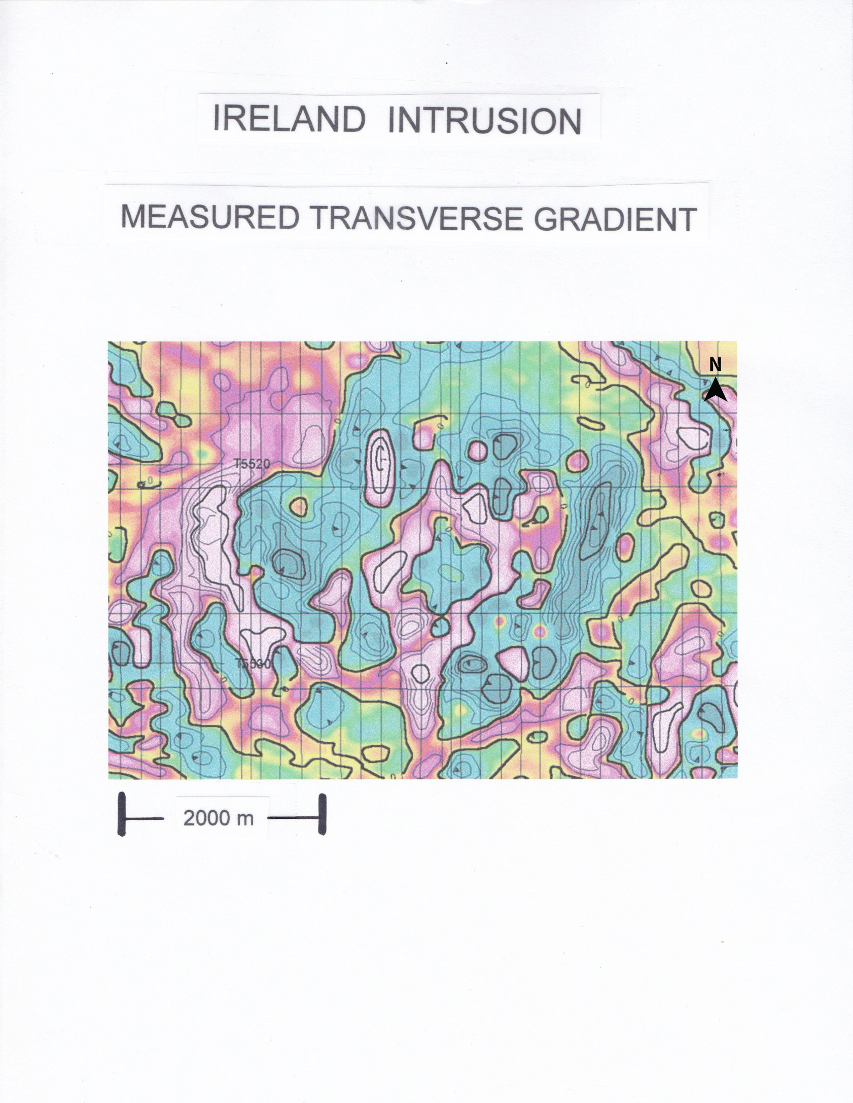
A large north-south trending fault is evident and slices the entire complex.
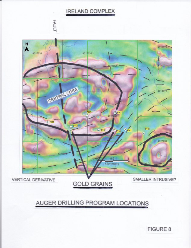
In 2010, a limited geochemical survey (soil sampling) conducted over the Ireland complex by previous operators identified elevated concentrations of the rare earth elements Ce, Gd, La, Nd, Pr, Sm, and titanium (mndm files 200000004588). The increased rare earth elements and titanium suggest an association with or the occurrence of a Carbonatite intrusive containing REE mineralization. A reconnaissance deep overburden sampling program was also initiated as a follow up to the soil sampling program. An auger drill was mobilized to the property and a total of eight holes were drilled (Figure 8). The maximum depth drilled was 75 m and thick overburden prevented bedrock from being penetrated in all eight holes. However, gold grains were recovered from holes FH - 01, 03 and 06 and strongly suggest the potential for the underlying Ireland complex to host associated gold mineralization (mndm files 20000004588/20006749). No assays were reported for the past auger drill program and the Company cannot therefore confirm the presence of gold without conducting its own drilling and sampling program.
Going forward and subject to financing, drilling is planned with the main focus to be on confirming the existence of a Carbonatite complex. The program will target the outer high magnetic rim for titanium, copper, iron and gold and target the inner low magnetic core for rare earth element mineralization (Figure 9).
The Ireland Complex and carbonatite target owned by the Company is an exploration target with no resources or reserves and is not known to host like-mineralization as is present at Niobec or other known Carbonatite complexes. The figures herein of the magnetic highs and lows of Niobec, and RTM's Ireland property, are general and interpretive comparative magnetic signatures only and do not represent the presence of REE mineralization on RTM's Ireland property.
(Swipe images on mobile)
QUALIFIED PERSON
The technical information contained in the above text has been reviewed and approved by Mr. Garry Clark, P.Geo., a “Qualified Person” as defined in National Instrument 43-101 – Standards of Disclosure for Mineral Projects.