CASE BATHOLITH PROPERTY
Project Description
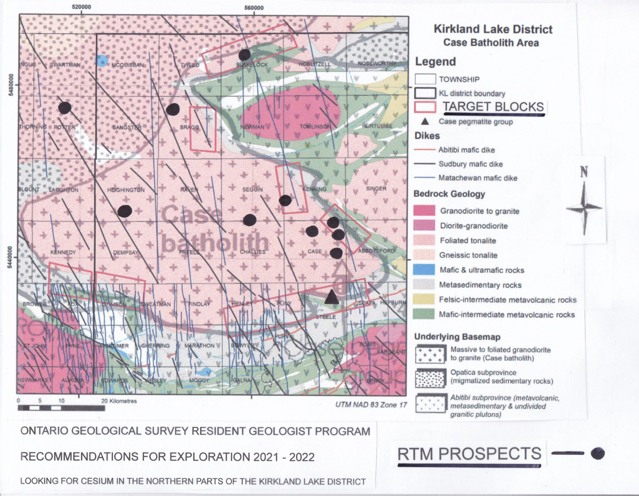
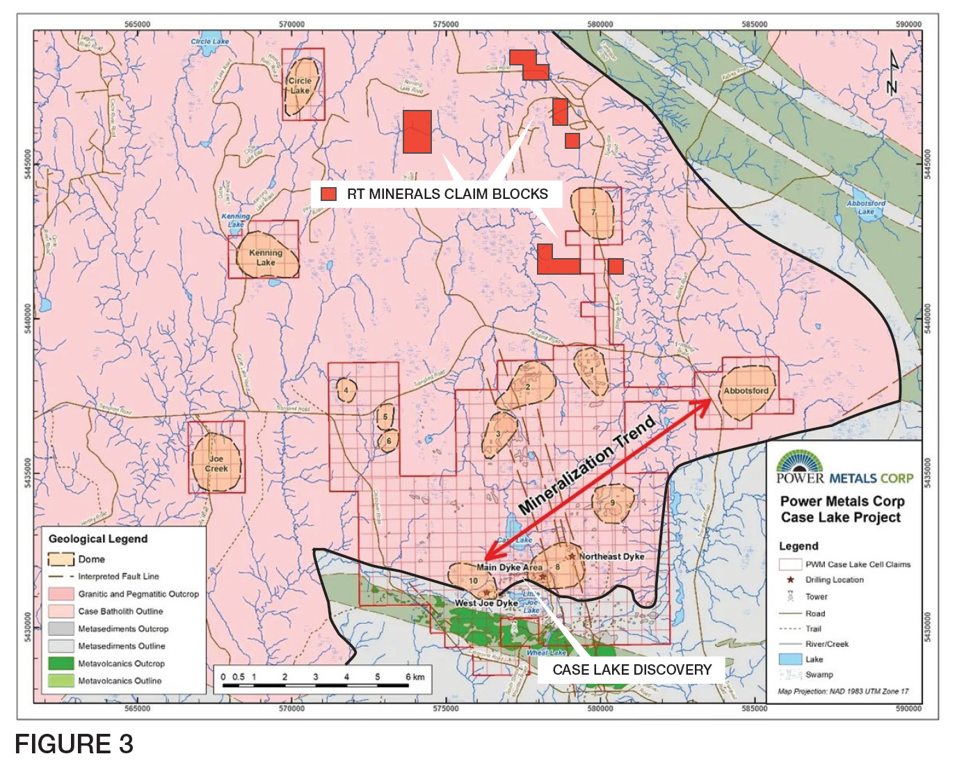
The entire Case Batholith complex is an oval shaped complex that is approximately 150 km long and 60 km wide. The Case LCT Pegmatite system is the fifth largest lithium rich system in the Superior Province of Ontario and may develop into the richest Cesium bearing complex in Canada. With the exception of the extreme southeastern edge of the Batholith where the Case discovery is located, the entire complex is virtually unexplored.
The Power Metals discovery contains significant resources of Lithium and Cesium mineralization within pegmatitic lithologies throughout northeast trending dyke and isolated Laccolith complexes. Three Pegmatite swarms (south, central and north dykes) strike at 060-070 degrees and dip 40-60 degrees north. The dykes are contained within a host rock of massive to foliated Biotite Tonalite to Granodiorite.
Drill intercepts include:
PWM - 22 - 143 (West Joe Dyke)
24.07% Cs, 0.63% Li20 over 1.0m
20.36% Cs, 2.28% Li20 over 1.0m
22.22% Cs, 1.46% Li20 over 2.0m
7.65% Cs, 1.45% Li20 over 7.09m
(Power Metals corporate presentation 2023)
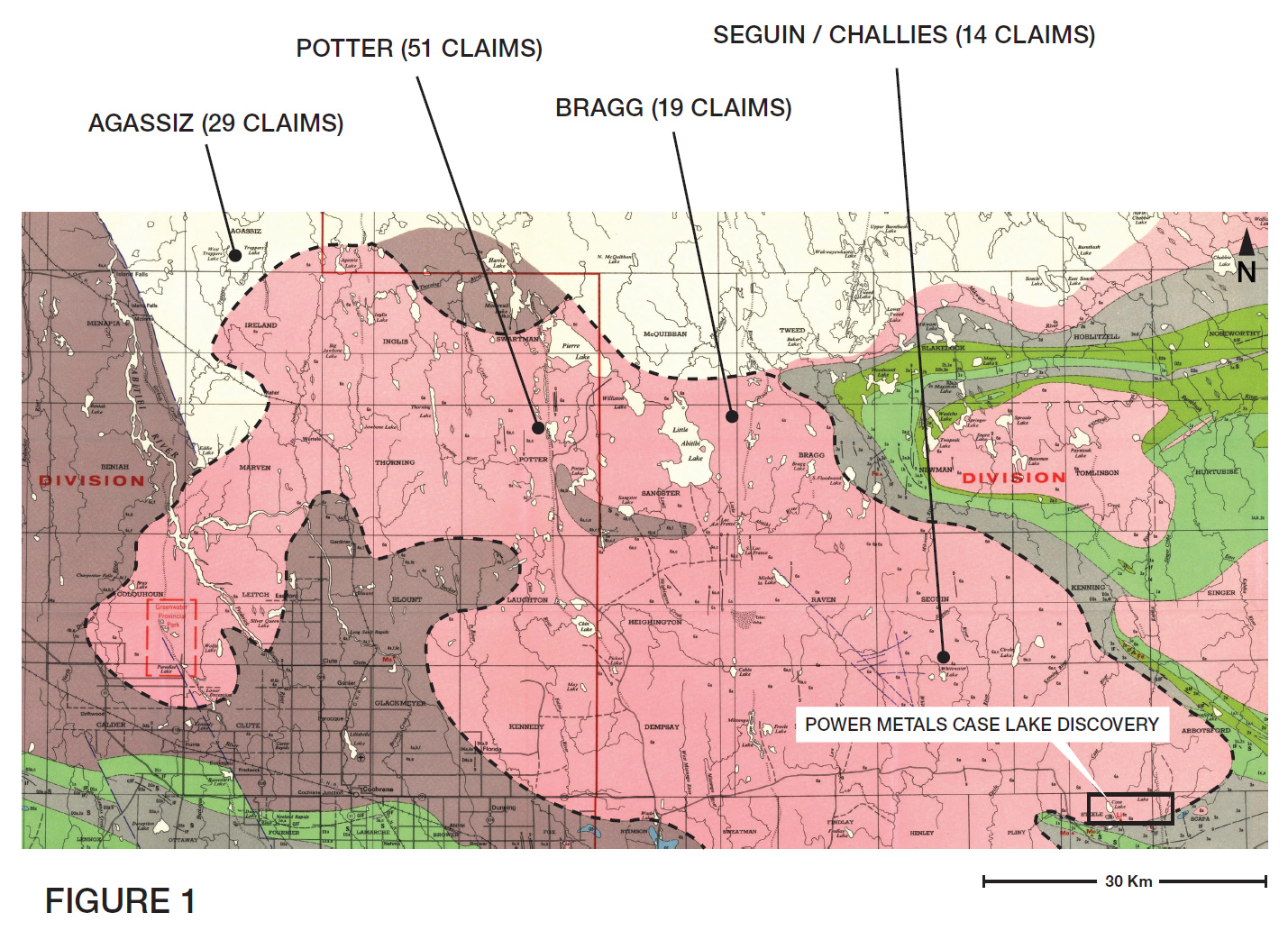
Excluding the Case Lake discovery, only one significant borehole has penetrated the Case Batholith. Lake Shore Gold drill hole LA-07-01 located immediately northeast of RT Minerals Ireland property in Ireland Township contained anomalously high Cesium values (10X background) within igneous assemblages (samples 135279-81, Cs-76, 42 and 56 ppm) (MNDM files 20000003914/20005893).
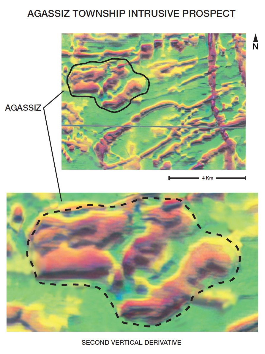
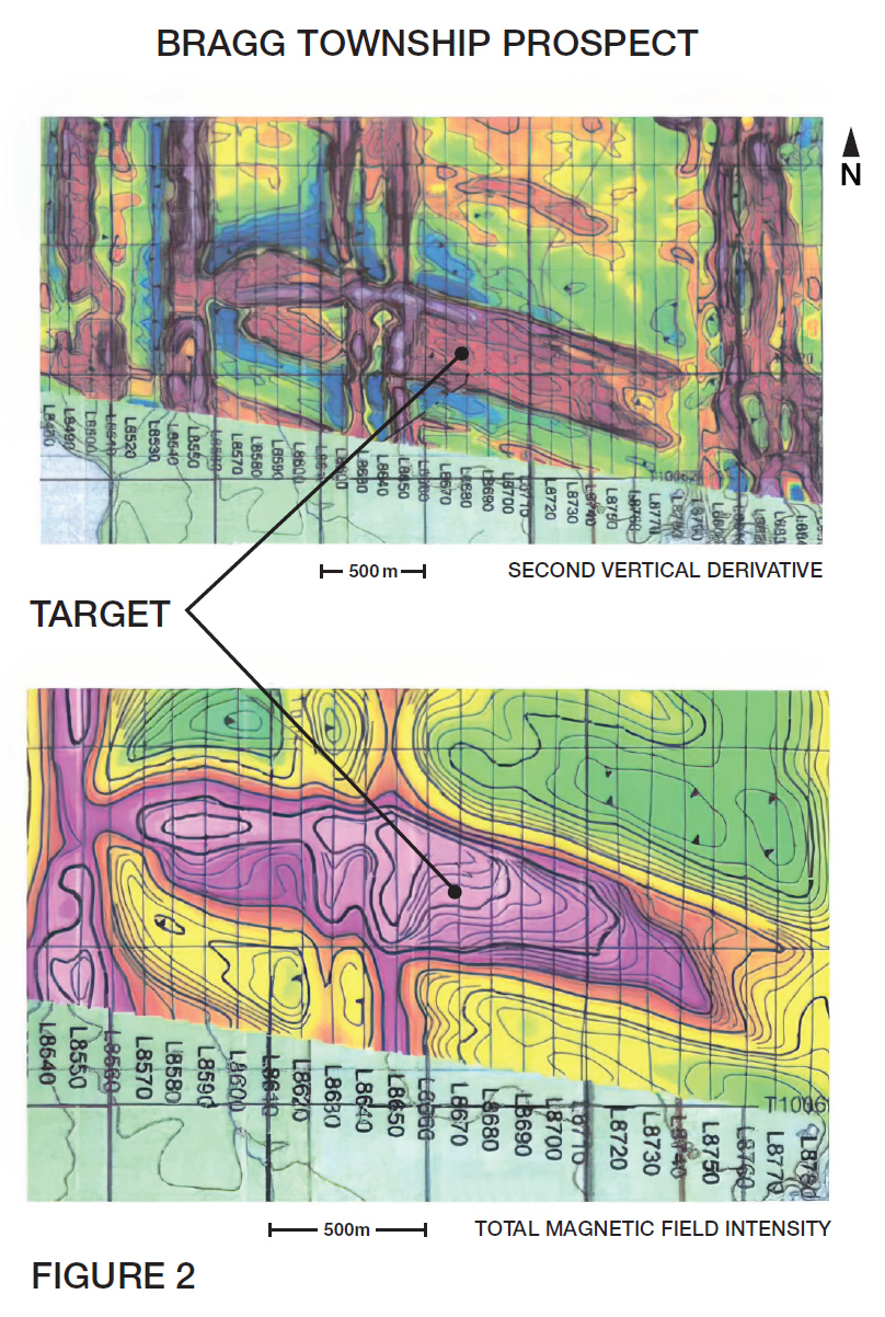
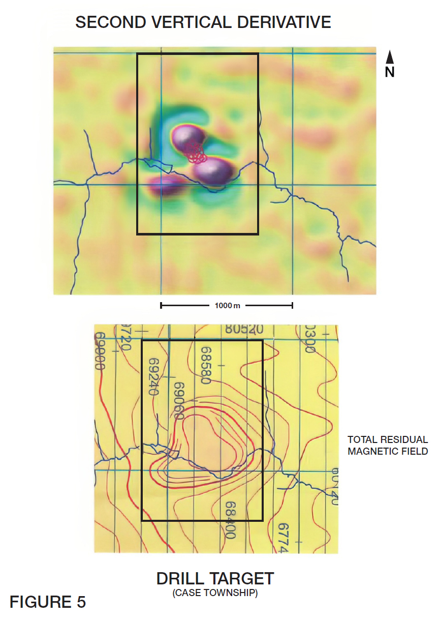
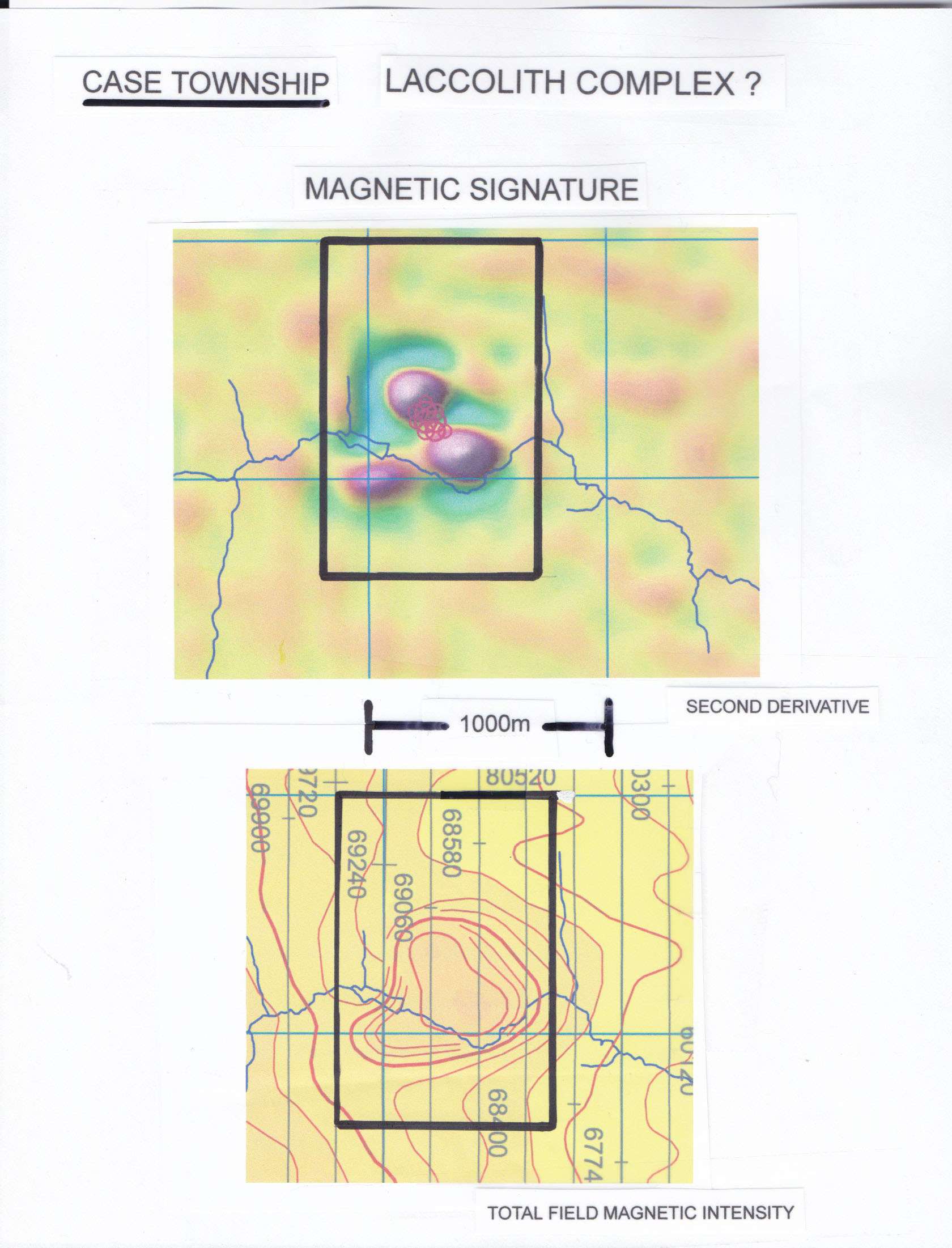
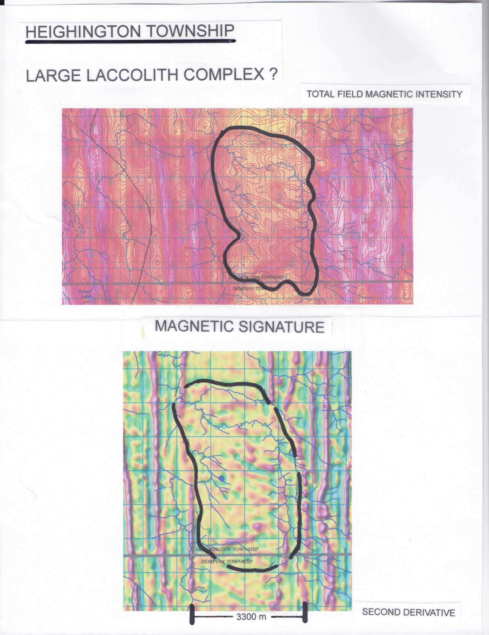
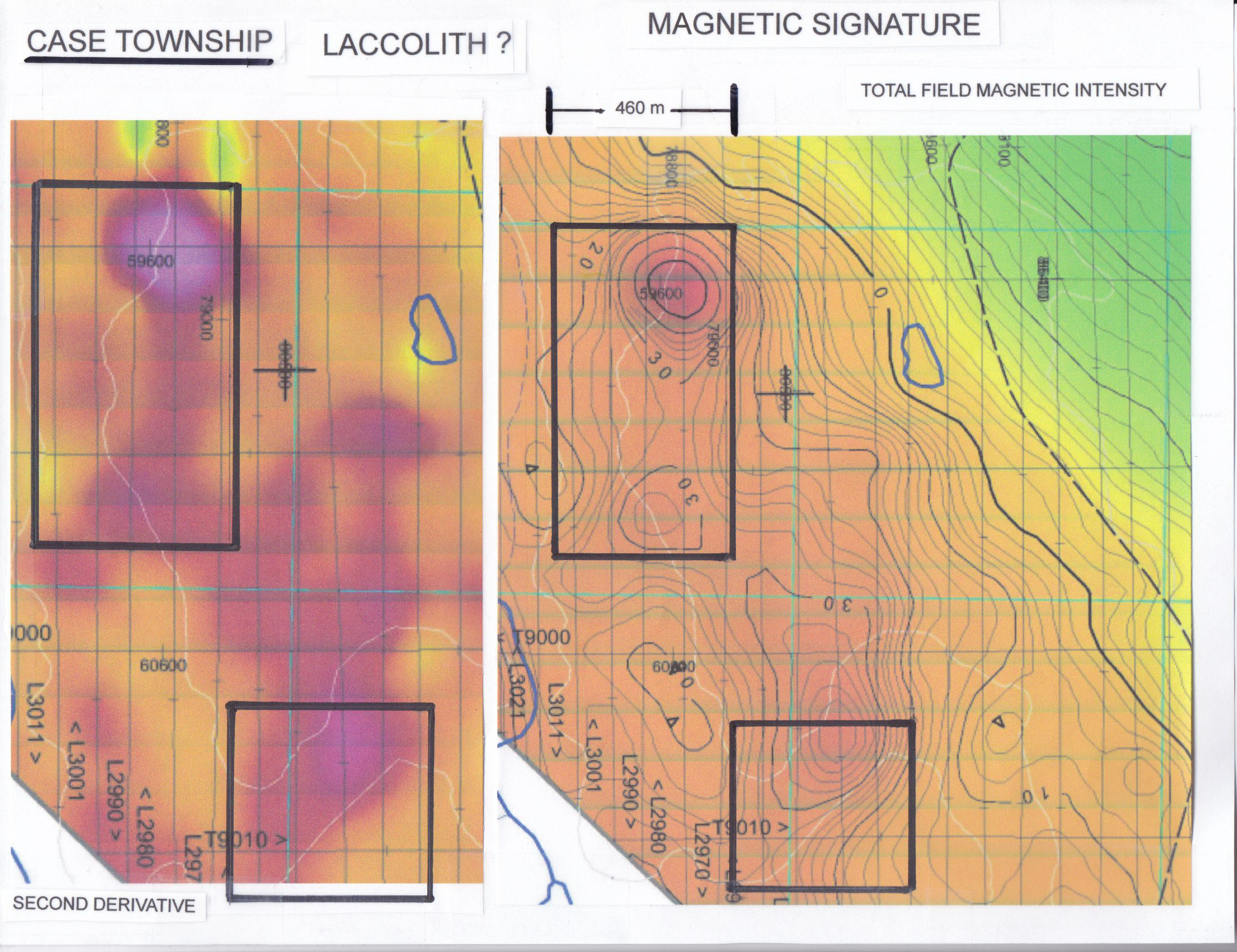
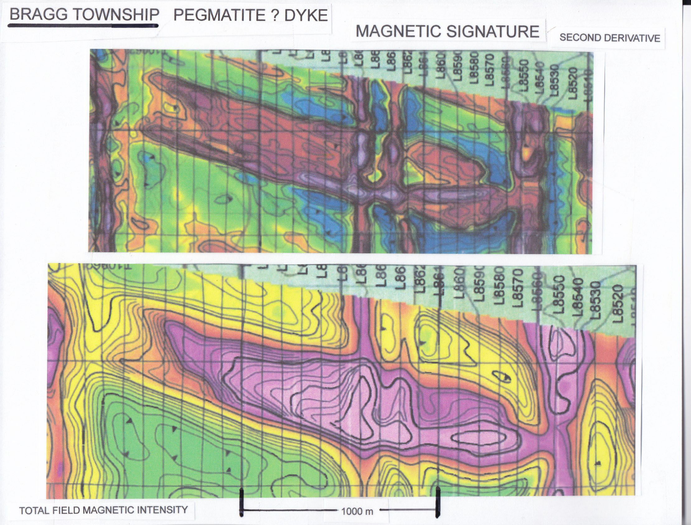
Detailed investigations from existing magnetic signatures covering the entire Case Batholith has resulted in the identification of several magnetic responses similar to that which characterize the Power Metals Case Lake discovery. All of the RT Minerals claim blocks have been acquired on the basis of magnetic signatures resembling northeast trending dykes and laccolith structures. The Total Residual Magnetic Field response exhibits several magnetic features located near the Case Lake discovery (MNDM files Map 82815).
It is postulated that many of the magnetic responses represent Pegmatitic dykes and laccolith (dome) complexes that are contained within the Tonalite/Granodiorite rock assemblages of the Case Batholith. Several RT Minerals claim blocks cover substantial magnetic features that lie along the outer margins of the Batholith (as does the Power Metals discovery).
The Company intends to commence ``Grassroots`` exploration involving locating and documentation of pegmatitic complexes on the properties, subject to financing. This will involve extensive rock sampling for geochemical analysis and assaying for the determination of the degree and direction of fractionation of rock assemblages and ultimate identification of rate earth mineralization.
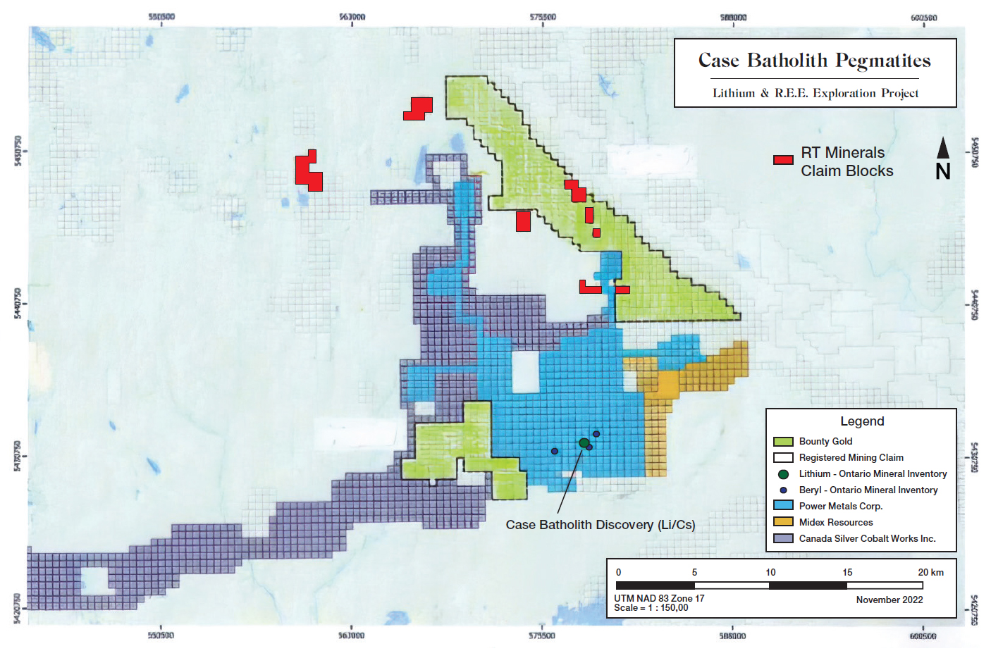
RT Minerals owns a 100% interest in the Case Batholith Properties and certain additional mineral claims are under acquisition agreements that are anticipated to close shortly. For more information on the Case Batholith properties, please refer to the Company's news releases of February 14, 2023 and February 28, 2023.
(Swipe images on mobile)


QUALIFIED PERSON
The technical information contained in the above text has been reviewed and approved by Mr. Garry Clark, P.Geo., a “Qualified Person” as defined in National Instrument 43-101 – Standards of Disclosure for Mineral Projects.